Showing posts with label maps. Show all posts

Sunday, September 11, 2011

3 Days on the Island - 2

Thursday. More rain. We decided to get on the road for the first half of the day and pick out some good wave-ski spots for when the sun appeared. We got down to Cape Bruny lighthouse, a handsome building designed by John Lee Archer (who also did Hobart's Parliament House among many others). In the 1830s it was lit by whale oil, and burned a pint of it per hour. It was manned for 158 years.

Around the lighthouse area are a few of those "no entry" signs showing the silhouette of a man with severe stomach cramps. Either that or he is making a beeline to give someone a good telling-off.

From there we took a side-road to have a look at Jetty Beach. So named because in the 1830s all the materials for building the lighthouse were landed there at a jetty and hauled overland about 10km to the cape. Apart from a small smelly dead shark, it was quite a beautiful spot.

There is a dirt (mud) road over Mt Mangana to Adventure Bay, so we took that in the hope of having a good view on the way over the top. The alternative is a much longer drive back through Alonnah. Unfortunately the road is pretty bad, it was raining harder and we never quite found the lookout. The road runs through dense tall trees and you really see nothing until you get back down to the coast.

Adventure Bay is really something though. On a better day it would have looked like this:
(Image stolen from Tasmania i-Drive)
Although it does not have a pub, it does have a general store, café, bowls club, caravan park, the Bligh Museum and Bruny Island Cruises. Until we drove past their sign we had forgotten all about those guys, which is surprising because they are a very high profile phenomenon. Elf ran in and booked us on a cruise for the next morning - it was pricey but very highly recommended to us by everyone who has done it.

We went into the Bligh Museum, which is an oddly masonic-looking stone building near Captain Cook Creek. It turns out this whole area of coastline hardly had five minutes peace between visits from Tasman, Cook, Bligh, Flinders, Furneaux and Bruni D'Entrecasteaux (who got the place named after him).

The museum is one of those classic enthusiast-run places with amazing journals and artifacts just sitting about, intermingled with bad photocopies of other documents and photos. Most of the explorers had some sort of South Pacific connection, which explains the startling rack of war clubs from Fiji, Tonga, the Solomons, Hawaii and New Zealand.

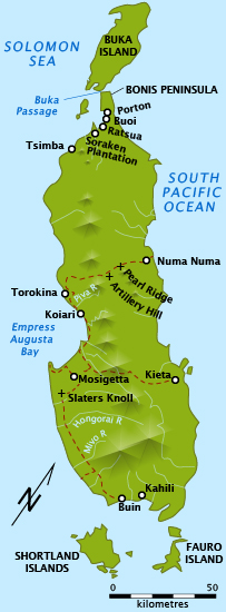
Something I thought was very interesting was a hand-coloured version of this map by Sir John Hayes.


I have never seen the old name for Tasmania, "Van Diemen's Land" applied to only part of the island. It is quite clear on the coloured version that Hayes considered this name as a Dutch claim to the part of the coast west of South East Cape. The other side of this point he considered to be his to name and claim, and he called the part south of the Derwent ‘New Cumberland’ and the rest ‘New Yorkshire’. He also called Mt Wellington ‘Skiddaw’. None of these names stuck.

So - forgive me if that seems really dull, it struck me as interesting. From the museum we ducked into the funny little general store for some general stores for lunch, then went into the Penguin Café next door for a pick-me-up. It is also a funny little place, crammed with crafts. The chunky knitted fish was a highlight. After coffee we drove back to Alonnah the saner but longer way.

After lunch, with the rain in recess, we got it in our heads to walk to the little Alonnah shop. It took about 20 minutes each way, along a narrow sometimes-dirt road, with occasional cars sending us lurching into the long grass. We got a few things and some lollies to keep up morale and struggled back again. At one point I could see along the beach to our neighbouring shack's boathouse, and I got everyone to follow me to try this great shortcut. Halfway there we realised we couldn't ford the creek without getting wet to the shins, so we retreated to the road.

Our shack had a great little woodfire, and we spent quite a bit of the holiday sitting around it, drying. That night we went to the pub (by car) for a counter meal. Today Tonight (junk current affairs for nongs) was on the TV. Exciting news, new university research has found an appetite suppressant that is helping people lose a kilo per week! It turned out to be a product already in the shops, made by Swisse, an incessant advertiser on this very channel. Sigh. Elf noticed a couple of days later that it was sold out in the biggest pharmacy here.

Monday, August 08, 2011

Nooget exploration and conquest

\mathbb{N} \mathbb{O} \mathbb{O} \mathbb{G} \mathbb{E} \mathbb{T}    \mathbb{E} \mathbb{X} \mathbb{P} \mathbb{A} \mathbb{N} \mathbb{S} \mathbb{I} \mathbb{O} \mathbb{N}


Michael makes the most adorably chubby maps of the world. On this one he has finally located for us his homeland he is always talking about, Noogetswan (the whale-shape in Siberia). Unfortunately the lines Michael has drawn show "Noogetswan conquering Tasmania, Iceland and part of Greenland". I asked him what the Noogets would do with these territories once they were in their thrall. Would they be kind to the Tasmanians, Icelanders and Inuit? "No".

Monday, July 04, 2011

Dawn breaks

Dawn breaks over Hobart

Tuesday, May 17, 2011

Holiday suggestion

This year, why not holiday in picturesque Holes Hole, Devon?
Thanks for the tip off (in an email from March 2010 which I just found) from a man
who claims to be Hamish McOffal of the Edible Organ Society of Victoria.

Thursday, December 16, 2010

From a Japanese map of the world, 1914

 
Why do I find this so unsettling?

Wednesday, November 24, 2010

About halfway between Ham and Sandwich

Sandwich, Kent, UK. Where you will find Sandwich Mowers, the Sandwich Technology School, the Sandwich Bookshop and my favourite, The Secret Gardens of Sandwich. And just out of town along Sandwich Road you come to Ham.

Tuesday, April 06, 2010

Wiki work

I have been putting in quite a bit of time drawing maps for Wikipedia. It started when I wrote a couple of articles, and felt they needed maps to make sense. One of the articles was about Arnold Potts, one of the heroes of the Kokoda Campaign in World War II. One of the old hands in Wikipedia insisted I write about Potts' time at the end of the war in Bougainville. It's very much a minor part of his story, but he was quite adamant. Turns out he is an authority on the Bougainville Campaign in 1945, which is generally seen as a sideshow to the main action of Guadalcanal, Iwo Jima, the reconquest of the Philippines and and so on. So now I have drawn a bunch of maps of Bougainville, and I am starting to get general requests from further afield in Wikipedia.


I really love being able to draw a simple map, that just locates half a dozen places in relation to a major landmark and provides a scale. It can make an article suddenly so much more comprehensible. The latest map I have done is for the Battle of Bita Paka in World War I, when Australian troops invaded German New Guinea and captured a couple of radio transmitters. I had never heard of it until I was asked to do it.

Monday, February 08, 2010

Boating, battling

On Sunday we went boating with Imp and Ed and the girls. It's Royal Hobart Regatta weekend, so we had our own tiny regatta by the slimy sucking mud of Castle Forbes Bay. The plan was to drive down to the Huon River at Franklin and hop in the water there, but there was nowhere for the kids to play safely when not on the water. We went a bit further south, where the river broadens out and there are a few bays. Where we ended up had a couple of little shingle beaches between the expanses of evil mud.

We launched the Tub and the wave ski and had a lovely time taking turns out on the bay. As Elf said later, thank heavens for all the little crabs, or the kids on the beach would have had nothing to do except find oysters to cut themselves on. The Huon Valley is very fetching (mud notwithstanding) and 100 metres out from shore riding a very slight swell, is a terrific position from which to appreciate it. (Note how I'm talking all nautical now, avast).

The girls (very proficient swimmers) wanted to try the wave ski on their own, so we let them have a paddle close to shore. This inspired Marcus to do the same - he handled it very well and I felt very proud of him, scooting around out there. I also took the Tub for a row on my own, which I think is a first - it handles beautifully when you're the only one in it. Well, except for a persistent swerve to port, due to a damaged starboard oar. Michael hopped in for a tour of the bay with me before we packed up.

On the way home Michael had a lot of questions about sea levels. "If the sea levels rise, then all the maps will be wrong!" He is also a bit obsessed with the dotted lines on maps, where boundaries are In Dispute Or Undefined. To Michael, these are "battles", eg India and China are "battling" in the Sinkiang region. He has predicted that with the sea level rising there will be more battles - I think he is imagining a wholesale wobbling and rearranging of all the borders and coastlines. I suppose in the long view he is right. I think Geoffrey Blainey said "no political boundary can ever be permanent".

Meanwhile Marcus is demanding to know where he can see oxygen as a solid.

Friday, January 22, 2010

Four wonders of the world


Michael had drawn the orange and yellow thing but not yet labelled it, so I asked him what it was. He couldn't remember what it was, or which book he had seen it in. I ran him through a few obelisk-y possibilities, and he settled for the Washington Monument.

Sunday, November 22, 2009

Michael looms over Tasmania

Michael asked nicely if I would get the relief map of Tasmania down off the wall. He then played with it for about an hour. Note: even when it is face down he can name the lakes and islands by the inverted flat bits/bumps. Hey - do you like what I'm doing these days with the little writing?

Monday, December 08, 2008

The Atlas of True Names


The Atlas of True Names reveals the etymological roots, or original meanings, of the familiar terms on today's maps of the World and Europe. For instance, where you would normally expect to see the Sahara indicated,the Atlas gives you "Sea of Sand", derived from Arab. es-sahra "desert, sea of sand".

This is very interesting. Most reviewers have mentioned how it makes the real world seem quite Tolkien-esque. My favourite: The Atlantic Ocean apparently means "World Stream of the Mountain of Mountains".

Find out more here. Thanks to Strange Maps for the link.

Friday, July 18, 2008

Michael's Online Map


Michael did a little drawing of a rainbow at daycare on Wednesday. All the way home in the car he chattered about how he was going to "draw a map to the rainbow". The map is tiny and doesn't reproduce well, but this is the title. He wrote on the back (in light blue that won't scan) "www.michael'smap.com.au/rainbows".

Monday, July 07, 2008

Quiet moments at work

One of the things I love about Roar is the bathroom. I like to read on the toilet, and I like to share interesting, thought-provoking and unusual reading material. So I appointed myself years ago as Toilet Librarian. When we were based in Hill Street in an old church, the toilet was actually a fully functional bathroom, with shower and bath. There wasn't much room for literature, and it often got soaked as it was within splash range of the sink.

In our Gore Street premises the bathroom has floor-to ceiling frosted glass, facing west, so in the afternoon especially it is a fine place to read. The toilet is safely housed in a stall. Every now and then I change the selection of 90s design magazines, art books, antique football annuals and atlases. Very popular at present is the almanac of false facts Areas of My Expertise by John Hodgman which is having a second run, by popular demand.

What moved me to actually blog about the facilities was the Atlas of NSW which is in there at present, open to a page of street maps of NSW towns starting with W. Each day (three times on average) I look over at the map of Woy Woy and think "This is a fantastic place to work".