I have been putting in quite a bit of time drawing maps for Wikipedia. It started when I wrote a couple of articles, and felt they needed maps to make sense. One of the articles was about Arnold Potts, one of the heroes of the Kokoda Campaign in World War II. One of the old hands in Wikipedia insisted I write about Potts' time at the end of the war in Bougainville. It's very much a minor part of his story, but he was quite adamant. Turns out he is an authority on the
Bougainville Campaign in 1945, whic is generally seen as a sideshow to the main action of Guadalcanal, Iwo Jima, the reconquest of the Philippines and and so on. So now I have drawn a bunch of maps of Bougainville, and I am starting to get general requests from further afield in Wikipedia.
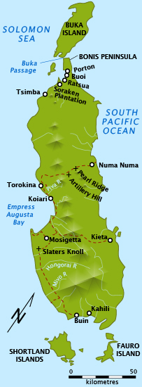
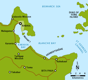
I really love being able to draw a simple map, that just locates half a dozen places in relation to a major landmark and provides a scale. It can make an article suddenly so much more comprehensible. The latest map I have done is for the
Battle of Bita Paka in World War I, when Australian troops invaded German New Guinea and captured a couple of radio transmitters. I had never heard of it until I was asked to do it.


No comments:
Post a Comment